At the end of my drive way, about 20’ to the left there is a decently large tree, that is only a couple of feet off the edge of the road. over the years it has become impossible to see if any cars are coming from that direction without pulling out into the road some. would it fall on me as the property owner to get the tree gone? Could it be put off on the county maybe since it’s in the right of way (?) being only a couple of feet off the road and causing a safety hazard for anyone pulling out of my driveway and onto the road? I live way out in the county if it matters? there Are also some phone lines very close to it. I don’t trust myself to chop is as I only have a slightly modified stihl ms170 saw and not enough experience with bigger trees. She’s very tall too. out of my skill ramge all around.


You are using an out of date browser. It may not display this or other websites correctly.
You should upgrade or use an alternative browser.
You should upgrade or use an alternative browser.
Slightly ot: whose responsibility is this tree?
- Thread starter Bradc1989
- Start date
depends on local laws, but typically, your land your problem, pay for professional removal.
now, that being said, typically any power line or cable companies that have a ROW on the phone pole will go out there and trim a tree to make sure it doesn't interfere with their stuff. if you can get them to do part (or all) of it then that solves the problem. if they cut down at least part of it, that might make the remaining a lot easier for you. however, don't call them up asking to have it cut down, just say it's interfering with the cable signal or you fear it's going to take down some power lines in a high-wind storm. then once they are out there, ask the cutting crew if they want to take it all down. you have to be careful how you word it because usually they are paid by the job as contractors, and they won't want to waste any more time on it than they have to.
now, that being said, typically any power line or cable companies that have a ROW on the phone pole will go out there and trim a tree to make sure it doesn't interfere with their stuff. if you can get them to do part (or all) of it then that solves the problem. if they cut down at least part of it, that might make the remaining a lot easier for you. however, don't call them up asking to have it cut down, just say it's interfering with the cable signal or you fear it's going to take down some power lines in a high-wind storm. then once they are out there, ask the cutting crew if they want to take it all down. you have to be careful how you word it because usually they are paid by the job as contractors, and they won't want to waste any more time on it than they have to.
Yea getting a crew out there to cut one tree sounds very expensive. Good idea on the line interference, I’ll see how close to true that is tomorrow . i May get my step dad out here to see if he would be interested in getting it on the ground. He knows his way around a chainsaw
I bet the phone co will take it down. They would rather do that then fix their line after Paul Bunyan Jr drops a tree on it. And tell them that the tree in their easement is blocking vision at an intersection and is a danger to motorists They have potential liability if there would be an accident
4xdog
Well-known member
...a decently large tree...
...getting a crew out there to cut one tree sounds very expensive...
This is almost certainly going to be your responsibility. The utility might help, as might the county. Worth a try.
What's the diameter of the tree's trunk? How tall is it? "Decently large" is too relative for us to have an idea of the scale of your project.
And "very expensive" is a relative term too. There are all kinds of tree guys, from pros with boom trucks and local country guys with ropes. Here in the Saint Louis area, if the tree isn't in a tricky area, getting one of those private guys from out in the country would be cheaper by far (like half or more), but the guys are unlikely to be insured for themselves or any liabilities.
iagsxr
Well-known member
Your location and a picture of the tree might be helpful.
Where I live county would take it down no problem if it's truly in the right of way and a safety issue.
I used to work for a buddy who did tree work on the side. We had a tree to take down that was in a horrible place in relationship to power lines and house. Got the utility company involved. They came in and trimmed it to where they deemed their lines safe, took down a third of the tree. At that point all we had to do was not hit the house with what was left standing.
I should add, my buddy's an electrical contractor for his main gig. Fully insured. We worked out of a 70ft. two-man bucket truck. Worked methodically and with safety always in mind. Spend some time watching "Tree Cutting Fails" on YouTube if you're thinking of having some yokel cut your tree.
Where I live county would take it down no problem if it's truly in the right of way and a safety issue.
I used to work for a buddy who did tree work on the side. We had a tree to take down that was in a horrible place in relationship to power lines and house. Got the utility company involved. They came in and trimmed it to where they deemed their lines safe, took down a third of the tree. At that point all we had to do was not hit the house with what was left standing.
I should add, my buddy's an electrical contractor for his main gig. Fully insured. We worked out of a 70ft. two-man bucket truck. Worked methodically and with safety always in mind. Spend some time watching "Tree Cutting Fails" on YouTube if you're thinking of having some yokel cut your tree.
Last edited:
Metal-Marc
Well-known member
You can also park nose out for free if you're that worried.
jack stand
Well-known member
It's probably in the ROW for the road, good luck getting either the count/town or the utility to remove it.
Understandably they only deal with it when it's clearly a road hazard (parts of it falling) or damaging the lines or they'd need a full time crew year round.
Understandably they only deal with it when it's clearly a road hazard (parts of it falling) or damaging the lines or they'd need a full time crew year round.
Zeke
Well-known member
As as tree trimmer once said, "Ma'am, I'll trim it for 500 or take it out for 350."
mitusa
Well-known member
Where I live, the county would likely come out and take it down. It might take a while, but they would eventually get to it.
tez929rr
Well-known member
Same here.Where I live, the county would likely come out and take it down. It might take a while, but they would eventually get to it.
Reminds me I need to call about one of mine. Base is starting to rot, if it wasn't on a blind curve I'd cut it myself.Where I live, the county would likely come out and take it down. It might take a while, but they would eventually get to it.
They're doing ditch work this week, I'll have them push it over with the excavator and I'll deal with it later.
77thor
Well-known member
Around here in suburbia, a tree only a couple of feet off the road would be on the city easement, therefore, city is reponsible.
4xdog
Well-known member
Same here in the Saint Louis area.in Texas, city would say we only have access to that part of the property due to easement, maintenance is YOUR responsibility and so is paying the property taxes on that easement
58Yeoman
Well-known member
I had a row of locust trees on my property line, right under the power lines. Just about every year, the tree cutting service from the power company would come and trim them. One year, there was a foreman with them, and I asked if he would rather just cut them all down. He agreed. I had him leave the trunks about 8' and that I would do those. They did all the brush, and left the good sized limbs for me also, cut to manageable lengths. Win for everyone. I then rented a stump grinder and ground up all 13 stumps. We have bushes planted there now that will never get that high.
Figure out where your property ends. If the tree is on your property then the answer is obvious. The only other thing to screw it up is some places the property line falls on the middle of the road and the county has an easement for the road.At the end of my drive way, about 20’ to the left there is a decently large tree, that is only a couple of feet off the edge of the road. over the years it has become impossible to see if any cars are coming from that direction without pulling out into the road some. would it fall on me as the property owner to get the tree gone? Could it be put off on the county maybe since it’s in the right of way (?) being only a couple of feet off the road and causing a safety hazard for anyone pulling out of my driveway and onto the road? I live way out in the county if it matters? there Are also some phone lines very close to it. I don’t trust myself to chop is as I only have a slightly modified stihl ms170 saw and not enough experience with bigger trees. She’s very tall too. out of my skill ramge all around.
Any R/W signs along the road? Any right of way signs usually indicate the property boundary.
firebirdparts
Well-known member
Probably on the ROW. Call the road commissioner.
GirchyGirchy
Well-known member
Any tree across the road to hang a big convex mirror on?
Sorry for the late reply guys heres a couple of pics. First one is what You see when you stop to pull out, much farther than that and your front end is getting out in the road. Second is for a better angle on how far it is from road. You can see the utility lines in the upper left hand corner of the first picture
Attachments


RPH
Well-known member
Unfortunately, unless somebody hits it and gets hurt, nothing will happen. Unless you hire a crew to handle it. If it gets sick then the possibility of removal as a hazard. We still have standing dead ash trees along the road from the emerald ash borer. They only get cut once they fall across the road or lines. Job security? Good luck!
driftpin
Well-known member
Old plats (or no plats) may show property lines going to the center of the road, but in my experience as a planner, the Right-of-Way (ROW) determines your front property line, and that is usually well-back from the pavement. For instance, a 40 ft ROW will be 12' of pavement on either side of the middle of the road (2 lane road), and 8' for utility easements on either side. They may include drainage, sidewalk, and lighting uses in the easement area. Sounds like the OP is in the country, and the area is unincorporated, so it's the county who has responsibility for maintenance of the ROW. If you have a sealed copy of your survey, the ROW and all lot lines should be shown.Figure out where your property ends. If the tree is on your property then the answer is obvious. The only other thing to screw it up is some places the property line falls on the middle of the road and the county has an easement for the road.
Any R/W signs along the road? Any right of way signs usually indicate the property boundary.
When real property is platted, the developer usually deeds the ROW to the city, village, county or other governmental jurisdiction. They may also do that if the property needs land for utilities like a lift station, stormwater maintenance like retention ponds and drainage piping, or other uses like utilities and essential services (fire/rescue & PD).
You can probably go to the county engineering dept and request to see the plat map for your property area, and request a printed copy. It may be online in some areas, but you would need to get the source website and go to a blueprinting business to get a 24" x 36" printout made, to-scale.
RPH
Well-known member
My front pin is 3/4’s the way across the state highway. I have a concrete Row marker that is equal to the front of my old farm house. If they want bigger road, I move.
Stuart in MN
Well-known member
Rather than speculating, do this - all it takes is picking up the phone. I'm in the city where trees on the boulevard are the city's responsibility, so it's possible a similar thing applies in your case.Probably on the ROW. Call the road commissioner.
You’re right, just though it would make for interesting conversation. Who would be be appropriate office to call? I’m fairly young at 33 and have never had to deal with any of the local governing bodiesRather than speculating, do this - all it takes is picking up the phone. I'm in the city where trees on the boulevard are the city's responsibility, so it's possible a similar thing applies in your case.
Edit: and yes I’m out in the country, way way out in the country
4xdog
Well-known member
Call the county government offices. They'll direct you (more or less).
Viper98912
Well-known member
In our area, an easement means that the property owner has to maintain it, but the city/county/etc can come in and mess it up at any time
p00p
Well-known member
clear the shrubs before the tree & it might increase the view of approaching traffic. That's what I would expect the local government to come back to you with (not necessarily in those exact words).
RPH
Well-known member
Road commission, your best bet at this point to argue traffic hazard. They cut trees here that they deem dangerous. Don’t expect to win on the first call, might take some time bugging them about it.
RPH
Well-known member
Personal toll road for 414 feet.
Right of way marker here in Michigan.
My northwest corner.
Right of way marker here in Michigan.
My northwest corner.
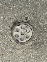
That last picture is almost certainly a cover for a water main valve. Want to upset all your neighbors, turn that off. (No, don't, your water company/town/city owns the valve.)Personal toll road for 414 feet.
Right of way marker here in Michigan.
My northwest corner.
evildky
Well-known member
In my city trees in the strip between the sidewalk and the street are required to be replaced if they fall or get taken down. Which is stupid as it causes visibility issues. complicating this a bit further, these is actually an easement belonging to the city but the homeowner is responsible for upkeep of these trees.
RPH
Well-known member
All rural here. Well and septic systems. I looked when they re-paved the road. There is an iron pin and it’s identified on survey along with row.
Pins go up and down the roads here.
Pins go up and down the roads here.
That last picture is almost certainly a cover for a water main valve. Want to upset all your neighbors, turn that off. (No, don't, your water company/town/city owns the valve.)
Youngandfree
Well-known member
Not the phone company I work for. We will take tree branches that have fallen and are pushing on our cable, but no way do they remove trees. And in no way do they do preventative maintenance on trees like the power company does. As a23 year field tech, don't bother calling the phone company.I bet the phone co will take it down. They would rather do that then fix their line after Paul Bunyan Jr drops a tree on it. And tell them that the tree in their easement is blocking vision at an intersection and is a danger to motorists They have potential liability if there would be an accident