The next day we took off into an area we had not explored at all before as I had read about some pictographs on someone's hiking blog a while back. I plugged the GPS coordinates of the pictorgraphs into GAIA and then worked backwards trying to link the closest trails to the pictorgraph's location.
The day started off Highway 6 about 15 miles north of I-70 at the Green River Cutoff trail. This is a direct road across the northern most part of the Swell and takes you to the Wedge, which is known as the "Little Grand Canyon". We have been to the Wedge a couple of times accessing it via a couple different trails but never from this direction. The goal of the day was to find the pictorgraphs, then head to the Wedge for lunch and then leave to the north of the Wedge and take a new to us trail down the east side of the Swell and return to I-70 about 40 miles west of Green River. This would be a long day so we left earlier than usual.
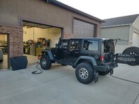
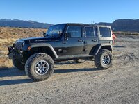
Here we are just pulled off Highway 6 to air down.

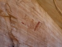
We eventually found the pictographs but it was a long search. Two of the trails in which I had previous marked using GAIA had been closed off using boulders and fencing so we had to locate alternative routes to the pictorgraphs. We ended up accessing them via very, very faint two-tracks that look like they haven't been used in quite some time.
The wife was getting anxious as we were about 25 miles off the main trail and I was basically trying to feel my way around a canyon by any trail we could find. The wife was ready to turn around and head back to the main trail and continue our plans for lunch but I was hell bent on finding the pictographs as it was a mission now.
We did finally locate them but it wasn't an easy route to access. I can see why they were on a hiking blog and not an off-road blog.



We then tried to pick an easier route back to the main trail but kept getting ridge locked and having to turn and backtrack. We eventually picked out way back to the Green River Cutoff trail and blasted down the road to the Wedge. Although we were slightly behind schedule we made good time and had a nice lunch spot. The Wedge Recreation area was actually quite busy as we saw the first other people in a couple of days of being on the trails.
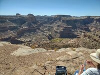
Our lunch spot overlooking the Wedge.
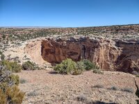
After leaving the Wedge we realized that we didn't have time to go the route I had originally mapped out, so we decided to head back by way of Buckhorn Wash Road. After realizing that Buckhorn Wash was a freakin' highway with all of the traffic and it being so dusty because they hadn't seen any rain in several weeks, I wanted to get off the main trail and find something more "remote" to have to ourselves. After playing with the GAIA app on my tablet I found a trail that somewhat paralleled Buckhorn Wash but on the other side of the ridge down in a wash. As we went through a gated area in the wash we came across this old mine that still had some components remaining.

We returned to town just about dusk and decided on dinner. We try to spread the love between a couple of our favorite places to eat. I was craving a steak and the wife wanted her teriyaki chicken.

This was from the night before's dinner from our other favorite place to eat where I ordered their pork chops. I seem to get these each trip as I have not found pork chops this delicious anywhere else.

More pictures to follow..